
Part of the Paths & Patterns Series
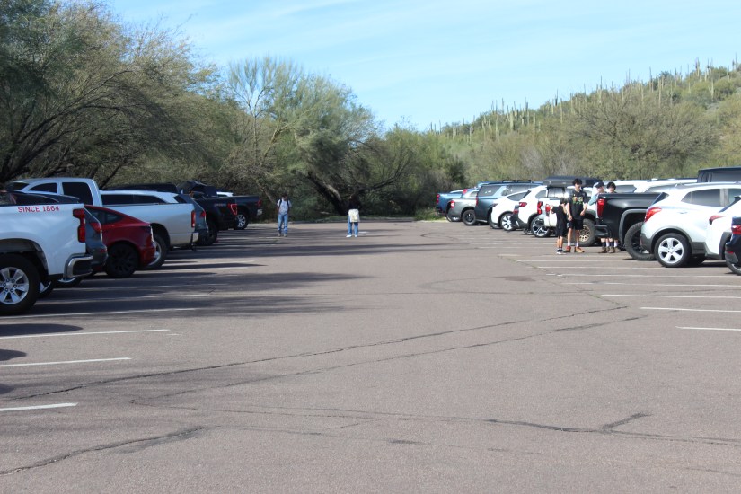
Arrived at Saguaro Canyon at 10 AM and the first thing you notice isn’t the trailhead—it’s the parking lot choreography. Vehicles circling like vultures, waiting for hikers to pack up and leave, drivers nudging into spaces as quickly as possible. We circled once before surrendering to the overflow lot we’d initially passed on the way in. Immediate evidence this trail is loved hard.
I almost died once on a hike up South Mountain’s Holbert Trail. My sister insists I was nowhere near death, but when you’re gasping for air halfway up a 1,000-foot elevation gain with no clear sense of how you’ll make it back down, semantics don’t matter much. That was my last time hiking Holbert Trail.
Recently, I wanted to investigate Butcher Jones Trail in the Tonto National Forest. Both trails are rated moderate by AllTrails.com. The key difference? Butcher Jones has a much more forgiving elevation gain at 638 feet compared to Holbert’s punishing 1,000. But what really drew me here was the numbers: 4.7 stars from approximately 11,000 hikers. When a trail gets that much traffic and maintains that rating, I want to know how—and at what cost to the ecosystem.
THE DAM THAT CREATED SAGUARO LAKE
Butcher Jones is nestled just about an hour east of the greater Phoenix area, but the area I was about to explore didn’t exist a 100 years ago, at least not in this form. Saguaro Lake was formed by the Stewart Mountain Dam on the Salt River, built between 1928 and 1930. Once a free-flowing desert river became a reservoir serving as storage for irrigation, municipal use, and hydropower.
A Saguaro Lake Guest Ranch was built in 1927 during the construction of Stewart Mountain Dam to host workers during the build. Around 1930, once the dam was complete, a couple from Kansas purchased the land to be turned into a public use area. The transition from industrial construction site to recreation destination was complete. Fishermen came first, then hikers, then… the Instagram and TikTok generation with their 11,000 AllTrails reviews.
This trail wasn’t built for scenic overlooks or social media sunsets. It was constructed for one functional purpose: giving fishermen access to the lake. But somewhere between then and now, it became one of Tonto National Forest’s most-visited sites. The land has been responding ever since.
The wildlife and Saguaro Lake remain open to the public for fishing and hiking with an Arizona Fishing Permit from Arizona Game & Fish and/or a Tonto Forest Parking Pass.
FIRST SIGNS OF STRAIN
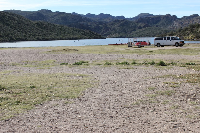
We fitted our water packs on our backs—pre-filled with chilled water bladders, protein bars, grapes, and hand sanitizer—and made our way through the bare recreational area near the lake. I took in the serene Saguaro Lake, then looked down at the ground beneath my feet: bare earth where grass once grew. This area hosts picnics, volleyball games, and serves as the launch point for fishermen entering the lake with their kayaks. The soil was packed hard, compacted by thousands of footsteps, coolers, and kayak launches.
A couple passing offered the advice of figuring out something else because: “The bathrooms are in dire need of attention.” Another small indicator of infrastructure struggling to keep pace with popularity.
TIP: Find the nearest restroom closest to Butcher Jones Trail before making the final trek into the Tonto National Forest.
THE TRAIL TELLS ITS STORY
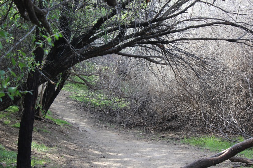
Immediately upon entry onto the trail, I noticed evidence of rerouting—new pathways carved to guide hikers away from eroded sections. Trail rerouting is one of the clearest signs that Butcher Jones has endured significant erosion over the years. The original path, worn down by boots and weather.
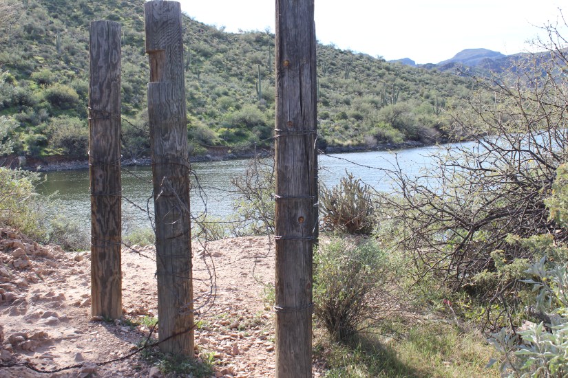
Further along, I spotted wooden posts wrapped in barbed wire—signs of an older redirect attempt. The posts stood weathered and half-buried, marking what was likely a previous effort to keep hikers on a designated path. Over time, even redirected trails can fail. Erosion doesn’t stop just because you move the route; it follows the foot traffic. These posts were evidence that this trail has been fighting the same battle for decades: how to guide thousands of hikers without letting the land wear away beneath them.
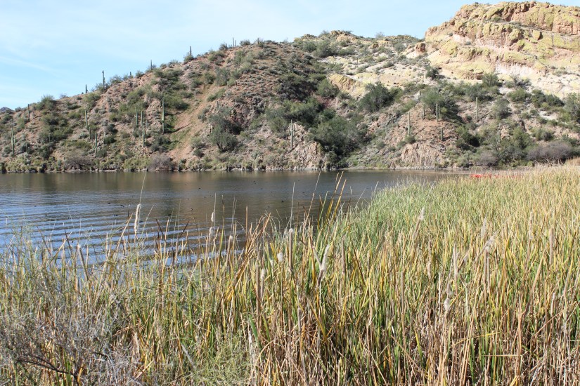
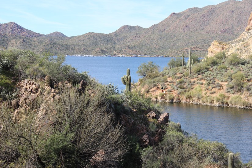
As the trail descended, it became very rocky—loose stones shifting underfoot, requiring careful placement of each step. But eventually it smoothed out as we headed back toward the ascent. I paused to witness Saguaro Lake from the opposite direction: beautiful and serene despite the busy day of traffic on the trail. The contrast was striking—nature’s quiet whisper alongside human activity.
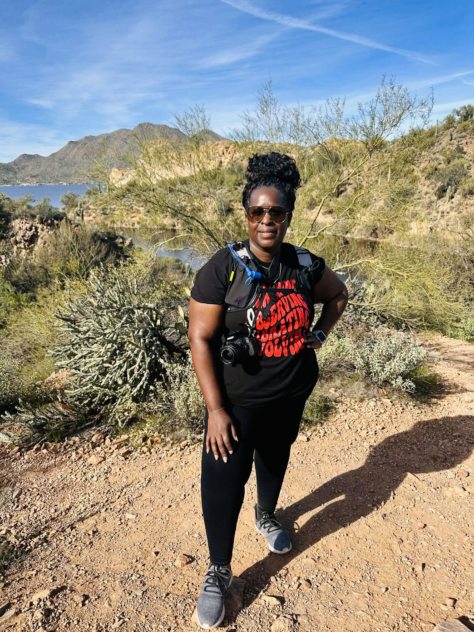
There was chatter from the group behind me that they hadn’t seen the trail as busy as it was that day. Halfway through the trail, I made the decision not to attempt the full ascent. My body has changed since my breast cancer journey (more on that here), and I’m still learning what it can handle now. In a way, I’m adapting to new limits just like the Butcher Jones Trail is—both of us responding to forces that reshaped us, finding new ways to function despite the wear.
In Arizona, this kind of self-awareness isn’t weakness—it’s survival. The Phoenix-area trails see hundreds of rescue calls every year. Knowing when to turn back can be the difference between a good story and a cautionary tale.
WHERE DID THE WILDLIFE GO?
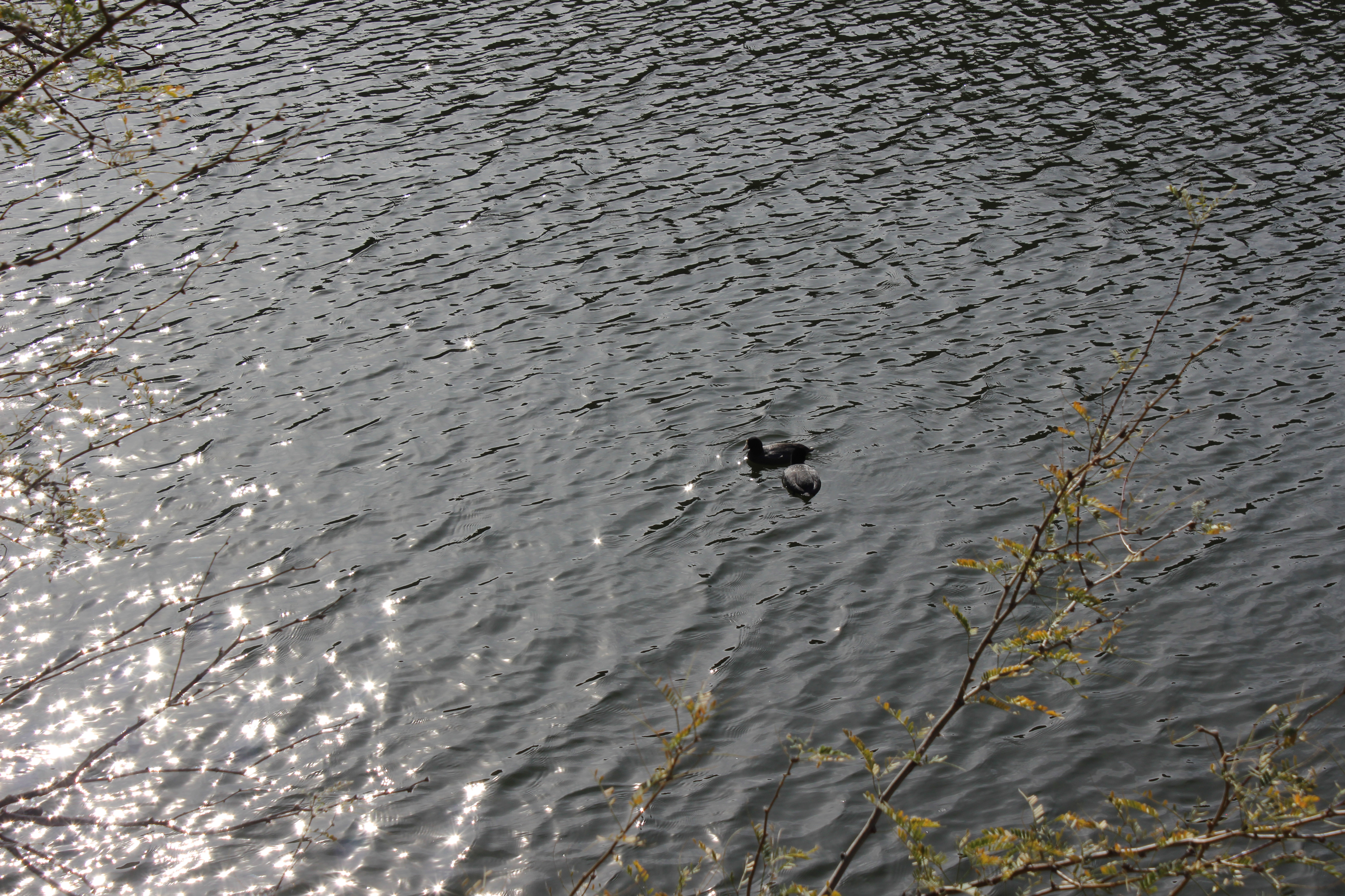
As we made our way back, I began to wonder why I’d seen no creatures besides ducks paddling quietly in the lake. I imagined even the smallest insect would land nearby for me to observe and capture. Nothing.
But then—a splash of color. Vibrant yellow flowers clustered along the trail’s edge, the only bright color in a brown and green desert palette. They seemed unbothered by the foot traffic, thriving in spaces where wildlife had retreated. Apparently, the animals had learned to avoid us, these wildflowers held their ground, blooming despite of.
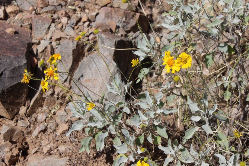
I’m left wondering if the wildlife in the area have learned to yield to pedestrians—retreating during peak human hours, laying low so-to-speak, before returning to their routines when foot traffic diminishes. Desert animals are adaptive by necessity. Perhaps they’ve simply adjusted their schedules around ours.
It’s a pattern I’ve noticed before: in my whale watching investigation here, I witnessed how Navy sonar disrupted migration routes, turning whales back north when they should have been heading south. Here, on Butcher Jones, the disruption is quieter but just as real. We don’t use sonar, but our presence—our volume, our numbers, our footprints—shapes behavior just the same.
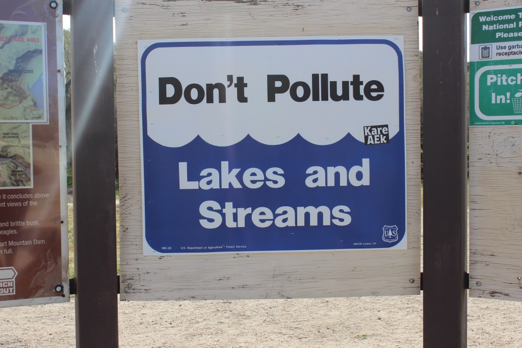
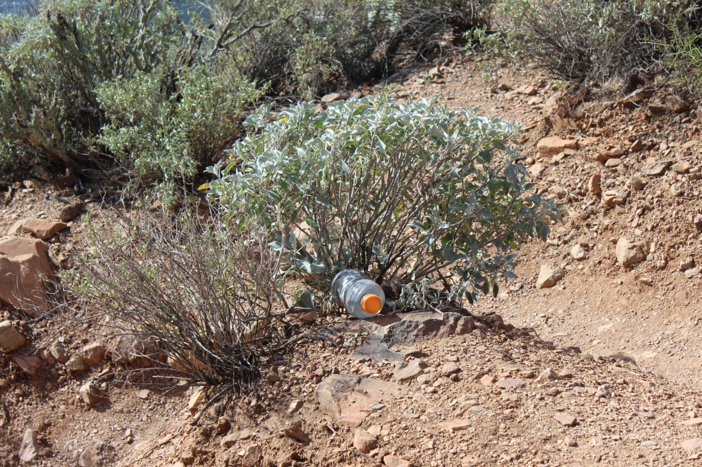
TIP: To keep the trail clean for future hikers and wildlife in the area, be sure to pack out all trash. What you leave behind doesn’t just affect the next human visitor—it affects the creatures trying to reclaim their space when we’re gone.
FINAL THOUGHTS: WHAT I CAME HERE TO NOTICE
What I intended to investigate:
How a trail rated 4.7 stars by 11,000 hikers holds up under that much love—and what it costs the ecosystem.
What I didn’t expect to see:
Bare ground where grass once grew, visible before I even reached the trailhead. The pressure doesn’t start on the trail itself. It starts in the parking lot, in the recreational area, in the small infrastructure struggles that signal a place stretched beyond its original design.
What I’m still wondering:
At what point does popularity kill the thing we came to see? Butcher Jones was built for fishermen in an era when a few hundred people might visit in a season. Now it hosts thousands. The trail has been rerouted. The grass is gone. The wildlife seems absent. The bathrooms are failing miserably.
And yet—it endures. The lake still reflects the canyon walls. The trail, though eroded in places, still guides us to views that take our breath away. There’s resilience here.
How I’m part of this:
I circled that parking lot. I added my footprints to the widened trail sections. I’m investigating this story while contributing to it, one more hiker among 11,000, one more person testing the boundaries of what a place can withstand. That tension matters.
Butcher Jones Trail Stats:
Distance: 4.8 miles out and back
- Elevation Gain: 638 feet
- Difficulty: Moderate
- AllTrails Rating: 4.7 stars (approx. 11,000 reviews)
- Location: Tonto National Forest, approximately 1 hour east of Phoenix
- Permits Required: Tonto Forest Parking Pass and/or Arizona Fishing Permit (if fishing)
This is part of my Paths & Patterns series—where I investigate how places and the people who love them shape each other. The goal isn’t to deter exploration. Explore with intention and attention, recognizing we’re all part of the story. The places we explore need us to see them, love them, and show up with curiosity and awareness.
- Multnomah Falls in December: Why Rainy Season is the Crowd-Free Version Nobody Talks About
- Salt River Wild Horses: How to See Them Before They’re Gone
- How to Explore Any Place Like a Local: 5 Meaningful Travel Tips
- Butcher Jones Trail Guide: What 11,000 Hikers Reveal About Saguaro Lake | Tonto National Forest
- USA Today Wine & Food Experience Review: Should This Festival Make Your Annual List?

Leave a comment