If you travel even a few times a year, you’re probably already spending enough to make the Costco Executive Membership pay for itself, and you just haven’t done the math yet.
When booking trips, Costco Travel is always my first stop for price checking. Rental cars are almost always less expensive booking through Costco Travel, and the thing that catches me off guard is not the deals themselves, it’s how quickly the 2% reward adds up without us changing a single habit. We book trips, rental cars, groceries, and household shopping the way we normally would.
Here’s how it actually works, broken down for people who travel and just function in a family household.
The Basics
The Executive Membership costs $130+tax per year. In return, you earn 2% back on most Costco purchases, including Costco Travel bookings. At the end of the year, Costco sends you a reward check. You can use that check to renew your membership for the following year, which means after Year One, the Costco Executive membership can essentially cover its own cost.
The catch everyone gets stuck on: you need to spend about $6,500 annually to earn that $130 back. That sounds like a lot until you think about what travel actually costs and how regular runs to Costco on a busy Sunday afternoon add up.
Where Costco Travel Earns Its Keep
Vacation packages. This is where the value gets real. Costco bundles flights, hotels, and sometimes rental cars or excursions into packages that are genuinely competitive often less expensive that what you’d piece together on your own. One vacation package can easily run $2,000 to $4,000 for two people. Book one trip like that, and you’re already a third to halfway to the break-even number without trying.
Rental cars. For us, rental cars alone can push the reward faster than expected, especially when we’re stacking road trips, business, and family travel throughout the year.
Cruises. Costco doesn’t always beat all cruise fares, but they frequently include Costco Shop Cards as part of the deal, which adds value on top of the base price. Book, cruise, and when you return you could have up to a couple hundred dollars on a Costco Shop Card sent to you. It’s worth comparing Costco Travel before booking anywhere else.
The Math
The number that matters isn’t really the total $6,500. If you already plan to keep a Costco membership, the Executive upgrade is only $65 more than Gold Star, so the real break-even point is $3,250 in eligible yearly spend. For most traveling families, that can happen faster than you think.
One vacation package, a few rental car bookings across the year, a trip here and there, and regular Costco shopping on top of that, groceries, household supplies, less per gallon on gas (note: gas doesn’t count toward the 2% reward) and you’ve more than likely passed the $3,250 upgrade break-even without even trying.
The reward check shows up. You hand it to the membership desk or to the cashier at checkout, and next year’s membership is covered. You keep shopping and traveling the way you already were.
Honestly, we’ve reached the 2% cash back $130 reward check without booking a single travel trip. And in the years we don’t quite hit the full amount, the reward still covers the majority of the upgrade cost, which makes it worth it either way.
What Else Comes With It
The 2% back is the headline, but the Costco Executive Membership also includes perks that are easy to overlook: discounts on home and auto insurance, Executive Member shopping hours, which I’ve used to dodge the infamous Costco crowds, and access to deals that aren’t available at the standard Gold Star tier. None of these alone justify the upgrade, but stacked on top of the travel value, they round out the picture.
The Honest Take
Costco Travel isn’t going to beat every deal on the internet every time. But it’s consistently competitive, the booking process is simple, there are live customer service representatives if you need assistance, and the 2% back makes it worth checking here first before you book anywhere else. I chase the best possible value on every trip, building a habit of checking Costco Travel as part of my booking routine and letting the reward take care of itself.
You’re already spending the money. You might as well get the membership back for free.
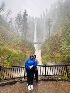
I looked left as we pulled into the parking space, then right — and there it was. 620 feet of water cascading from the earth’s edge. Edward and I stood there with our mouths open, watching it move the way it has moved for thousands of years, with or without anyone watching.
I said it out loud: this is the coolest thing I’ve ever seen in real life.
The Falls Most Visitors Never See
There was almost no one there. A handful of people with umbrellas, hoodies, or nothing at all, standing in the December drizzle watching a waterfall move exactly the way it has moved since the ice age carved it.
Oregon’s tallest waterfall, Multnomah Falls, is visited by two million visitors a year. Most come in summer, in sunshine. They get the mist, the photograph, the bridge shot. Then they leave. What most visitors don’t get is this version. The falls running hard from weeks of Pacific rain.
The Man Who Left His Name in the Concrete
But here’s the question I couldn’t shake standing there: how did anyone build a bridge across this?
In 1914, a subcontractor named R.L. Ringer rigged an aerial trolley to bring materials up the cliff side, then he built a temporary wooden structure to suspend the concrete arch while it was cured. The concrete pour ran for more than two days without stopping. This was one of the first continuous-pour concrete bridges in the United States. Stop once and the whole thing fails.
It didn’t fail. More than 100 years later the concrete still tests strong.
Benson Bridge at Multnomah Falls is named after Simon Benson, the man who funded it, but look a little closer and you’ll find another name etched into history. Ringer, the contractor, left his mark in the concrete. After being told to remove it, he cleverly pressed the letters back in with wet clay so the cement wouldn’t bond. After two winters of frost, his name set for good. And still, it remains.
77 Waterfalls in 80 Miles
The Columbia River Gorge where Multnomah Falls lives has been drawing people since before there were roads to bring them. TLC told us not to go chasing waterfalls. The Columbia River Gorge has 77 of them, including Multnomah, Latourell, Bridal Veil, and many more—carved by catastrophic flooding at the end of the last ice age.
What Catastrophic Water Leaves Behind
Missoula Floods are what geologists call them. Water so catastrophic it reshaped the entire Pacific Northwest in a matter of days. What remains is an 80-mile canyon that does something unusual for a natural landmark — it gets more dramatic, in a safe way, in what we’d consider bad weather. Rainy season in the Gorge runs roughly November through March. Precipitation feeds the falls and forces the falls to run harder and fuller than at any other point in the year. Nobody tells you that the falls have a whole other life. You just have to show up for it.
The Kind of Green We Don’t Have Language For
We drove down from Seattle, where we’d started the trip, in the kind of dewy drizzle that doesn’t demand anything — wipers only on periodically, sunroof open, inhaling the fresh air, coasting through the kind of green we don’t have language for in Arizona. Some things just resist the frame.
I Found the Quiet Version and Immediately Made Noise About It
I have written about overtourism. I have stood in places carved out by volume and wondered what they looked like before the algorithms found them. I came to Multnomah Falls on a rainy Sunday in December and felt righteous about it — the crowd-free version, the real version. And then I took out my phone. Not to document the falls. To tell someone they should come here. To say quietly, but screaming internally that this place is worth it, that rainy season is the secret, that if you time it right you get something most visitors never access. I was already turning the experience into instruction. The question I couldn’t answer standing there: is writing about it any different than photographing it? Or am I just another person who found the quiet version and immediately made noise about it?
Communion
We closed out the day at Communion, a Black-owned restaurant in Portland where the food was extraordinary and the room felt like someone had built it deliberately, for people who actually live there.
Traveling During a Healing Season
Base of Multnomah Falls. Photo: Sharonda Shariee
My oncologist had given me a small window. Between treatment cycles, a brief stretch where travel was possible if I was careful, if I didn’t push, if I let the itinerary be loose and the pace be slow. The Pacific Northwest had been on my list for years. It seemed like the right kind of quiet — not resort quiet, not curated quiet, but genuinely unhurried. Green and cool and indifferent to schedules. I didn’t go to Oregon as a travel writer. I went because I could. Because that particular Sunday in December standing at the base of a 620-foot waterfall in the rain with almost no one around, was available to me — and I knew enough by then to know that available is not the same as guaranteed. It isn’t about timing the crowds or finding the secret season. It’s about showing up with enough stillness to actually receive a place. To let it be what it is rather than what you needed it to be. I needed it to be exactly what it was.
The Lesser Version
Go. But go correctly. Sometimes that just means going in the rain. Multnomah Falls will be there in July. Crowded, photogenic, exactly as advertised. The bridge will be full. The lot will require a timed entry permit. It will also be there in December, in the rain, running harder than it has all year, with hardly anyone watching. I don’t know what it means that we built an entire tourism infrastructure around the lesser version. I don’t know if writing this changes anything — whether the people who need the quiet will find it, or whether this post becomes just another entry point for the crowd. What I know is that I stood at the base of something ancient and said out loud, to no one in particular: this is the coolest thing I’ve ever seen.
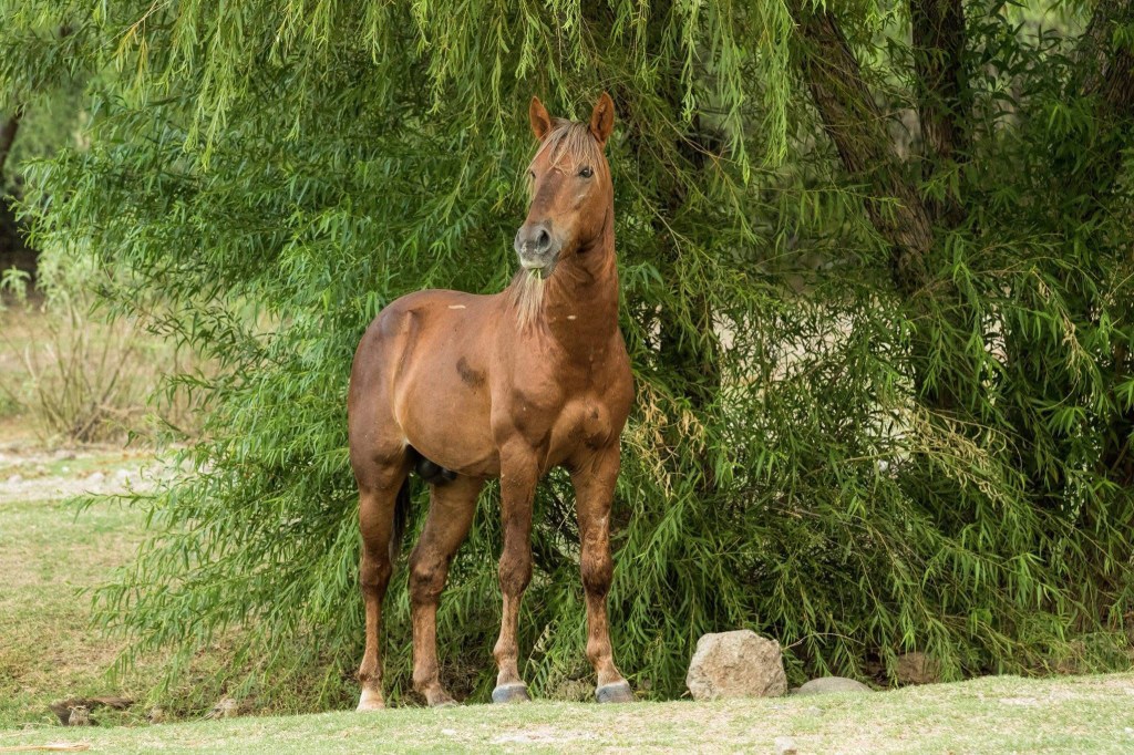
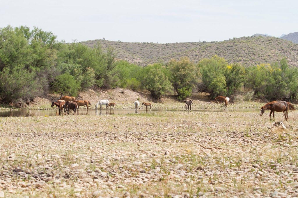
Salt River Wild Horse Herd: (Photo credit: Patrick Smith)
HOW IT STARTED
Wild horses have never been high on my list of must-see animals. But after years of hearing how people go out of their way and even travel from neighboring states to track down the Salt River wild horses in Arizona, I kept filing the hike away under eventually. Then I started to wonder what I was missing. Then curiosity got the best of me, and as part of my Paths & Patterns series, I had to go investigate for myself.
Patrick Smith, friend and professional photographer, is an expert explorer and frequents the many hiking trails in the Tonto National Forest area exploring the native wildlife. I randomly asked if he had been out to see the Salt River Wild Horses, and he replied he had, and he photographs the horses often. Over weeks, he debriefed me on how to navigate the area, and finally I felt equipped enough to make the trek through Coon Bluff Trail.
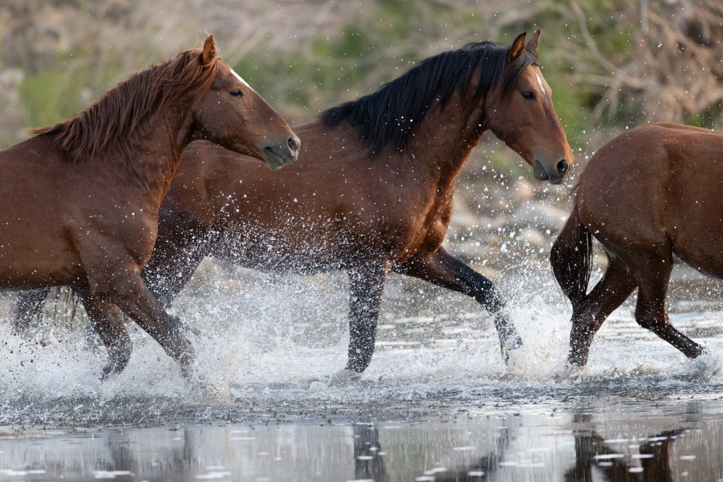
Salt River Wild Horses Scuffling (Photo credit: Patrick Smith)
A NOTE ON THE TRAIL NAME
Now, you may think the name Coon Bluff Trail is a little suspect, but hold on, the name is short for Raccoon. The trail was given its name back in 1919 when a group of boy scouts trapped a raccoon on the trail and pranked their parents into believing it was a different type of meat. The name has since been controversial, even The U.S. Board on Geographic Names’ Domestic Names Committee considered changing the name, and the USDA Forest Service already formally refers to the trail as Raccoon Bluff Day Use Area. So, since we have cleared that up, the trail is accessed via the Coon Bluff Recreation Area. You will need a Tonto National Forest day pass to park.
FINDING THE HERD
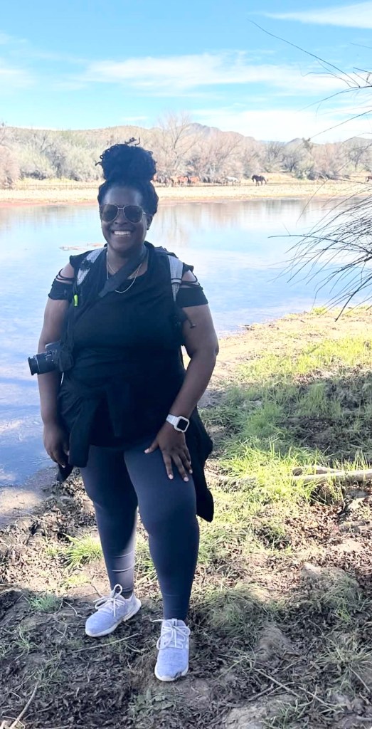
The face you make when the Salt River delivers. (Photo Credit: Sharonda Shariee)
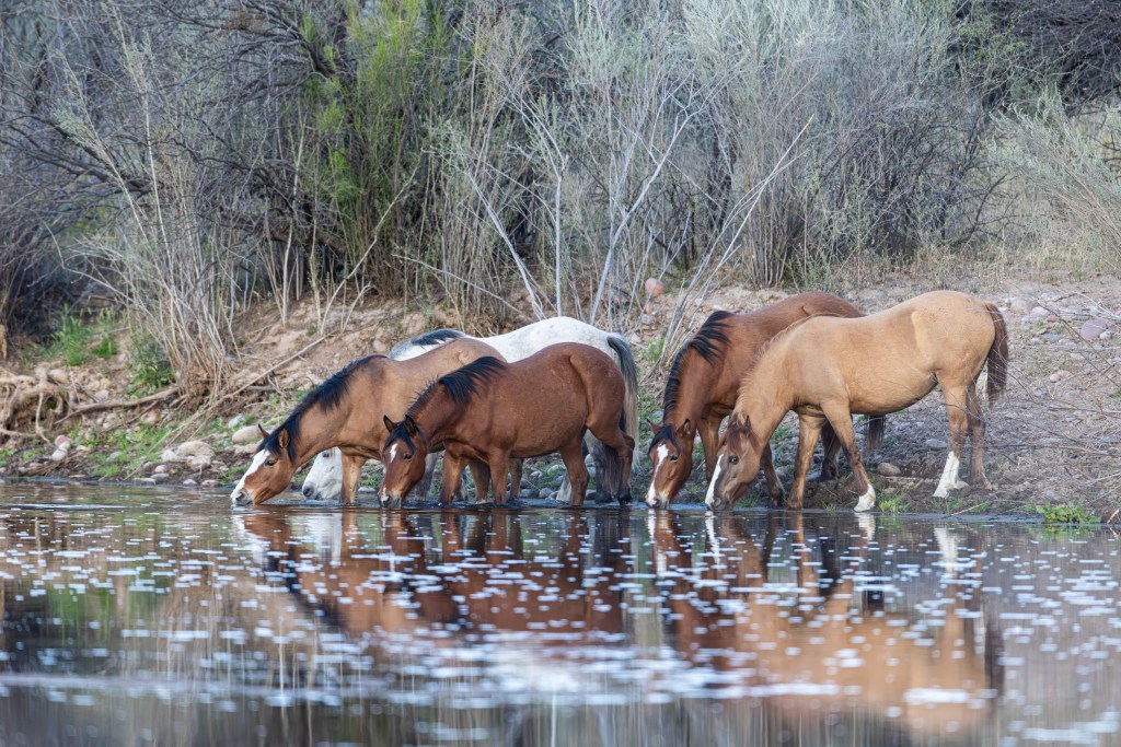
I immediately knew that I would not even have a chance of seeing the Salt River Wild Horses until I reached at least one mile into the hike, Patrick said do not even start looking until then. I kept close watch on my fitness tracker, and at the one-mile mark we started asking others on the trail walking from the wilderness we were approaching if the horses had been spotted. First couple: no horses. Second group: no luck, better chance at dusk or dawn. Third couple: “Yes, we saw them. Stay close to the river and when you feel the trail start to ascend, stay low.” I checked my fitness tracker, and 1.21 miles in, there they were. The investigation ended. I felt like the trail had finally decided to let me in on its secret. Let me warn you, there is a chance that you will not see the Salt River Wild Horses. If you go in knowing this, it lessens the disappointment, but also, be persistent and do not be afraid to ask other trail hikers if they have seen the Salt River Wild Horses, it is a normal banter on the trail.
Salt River Wild Horses taking a Hydration Break. (Photo credit: Patrick Smith)
TIP: This hike will take more out of you than you expect. Eat a solid meal before you go, hydrate well before you hit the trail, and bring more water than you think you need. The terrain is uneven, the sun is relentless, and the mile back feels longer than the mile in. A hydration pack is your best friend out there. I used my hydration pack the entire way.
UNDERSTANDING THE BANDS
Finding the bands matters more than you might think. The Salt River Wild Horses are not stationary, they are constantly on the move, following their natural grazing behavior and daily roaming. They come down to the river to drink, graze along the banks, and then retreat back into the forest as part of their routine movement patterns within their home range. Catch them at the wrong moment in that cycle and you will walk the entire trail and see nothing but beautiful desert landscape along the moving Salt River, which there is nothing wrong with that.
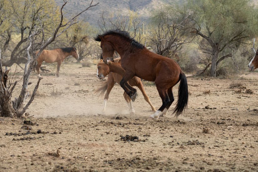
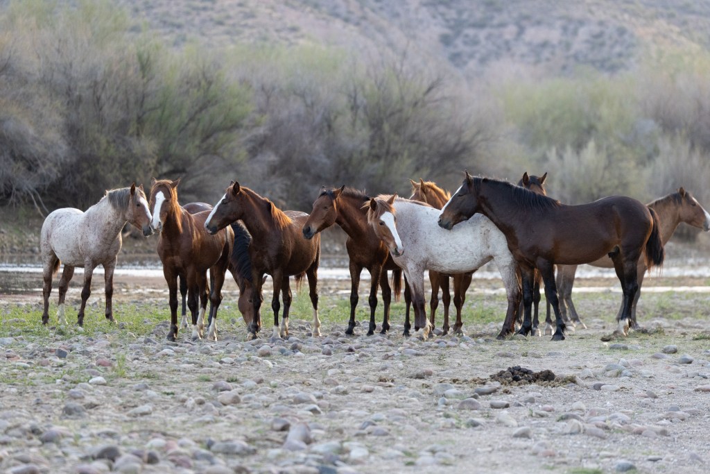
Salt River Wild Horse Band: (Photo credit: Patrick Smith)
WHO IS PROTECTING THE SALT RIVER WILD HORSES
What helps sustain the bands between those cycles is the work of the Salt River Wild Horse Management Group, an Arizona-based 501(c)3 nonprofit dedicated to monitoring, studying, and protecting the Salt River wild horses. They supplement the horses’ grazing with additional feeding, helping the bands maintain their health and numbers in an environment that, similar to the Butcher Jones Trail, you can read here, is feeling the same pressure of growing human presence.
Salt River Wild Horses Grazing: (Photo Credit: Patrick Smith)
WHAT’S COMING FOR THE SALT RIVER WILD HORSES
What makes this moment particularly urgent is that the Salt River wild horses are at a crossroads. Patrick has photographed these horses for years, and he has watched the numbers fluctuate dramatically, and with that, watched the forest floor change beneath them. More horses mean more grazing, more wear and tear on the forest floor, more pressure on the habitat that both the horses and the surrounding wildlife depend on. He does not advocate for or against what comes next. He just knows what changes he has seen.
The community is divided, but what I have learned is the herd must be reduced from approximately 274 horses down to about 120. That is more than half. Roughly 25 horses per year will be relocated to pre-vetted sanctuaries, with fertility control slowing future growth in the meantime. Relocation will begin in September 2026, which means this summer is the last time visitors floating the Salt River will see the herd at its current size.
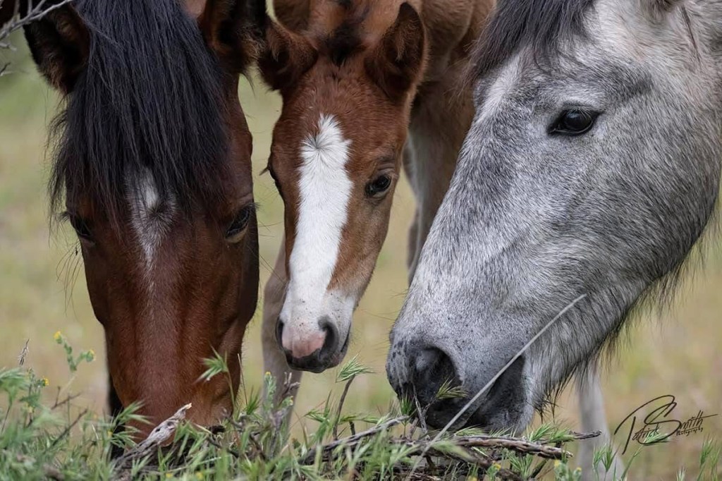
Salt River Wild Horse Foal: (Photo Credit: Patrick Smith)
WHAT I LEFT WITH
I came to Coon Bluff Trail curious and left with insight into a world that I was not necessarily interested in but left enlightened to the joy that these horses have brought the community near and far, and a sense of quiet urgency within our wildlife environment. These horses are a wild family navigating the same pressures the rest of us are, shrinking space, growing crowds, and forces beyond their control making decisions about their future.
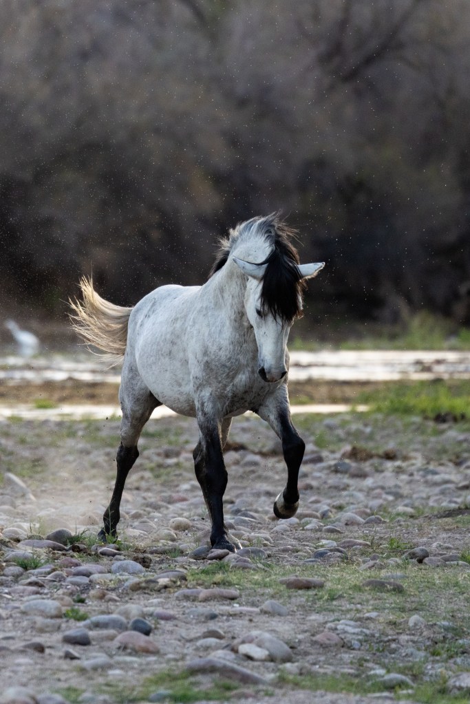
Salt River Wild Horse: (Photo Credit Patrick Smith)
Go this summer.
Go before September.
Go while the bands are still whole.
Seeking out the Salt River Wild Horses may not have been high on my list, but I will forever keep up with their story and how they are faring.
Salt River Wild Horses Grazing in the Open: (Photo Credit Patrick Smith)
This is part of my Paths & Patterns series, where I investigate how the places we love and the creatures that inhabit them are shaped by the world closing in around them.
A note on the photography: The images in this story were taken in collaboration with Patrick Smith, a professional photographer based in the Phoenix area. Whether you’re looking for wedding coverage, family portraits, events, or birthday sessions, Patrick is available for bookings at (602) 989-3601 or pat@ddifotography.com.
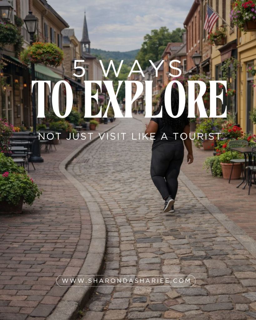
There’s a difference between visiting a place and exploring it. Tourists rush through landmarks, checking boxes on an itinerary. But true exploration? That happens when you slow down, pay attention, and let a place reveal itself to you.
No doubt I’ve been guilty of checking the boxes, at least a couple of days out of the itinerary. After years of wandering with intention, I’ve learned that the most meaningful travel moments don’t come from seeing the “must-dos.” They come from noticing the small details — the rhythm of daily life, the taste of something you can’t pronounce, the conversations that happen when you’re genuinely curious.
Here are five ways to explore a place deeply, no matter where you go.
1. Eat Where the Locals Eat (and Ask What They’re Having)Skip the restaurants with menus in five languages posted outside. Instead, look for:
Places packed with locals at lunchtime
Hole-in-the-wall spots with old-school typewriter menus
Markets and food trucks where people are actually eating (not just taking photos)
Tip: Don’t just order the “safe” option. Ask the server or the person next to you what they recommend. Some of my best meals have come from pointing at someone else’s plate and saying, “What are they having?”
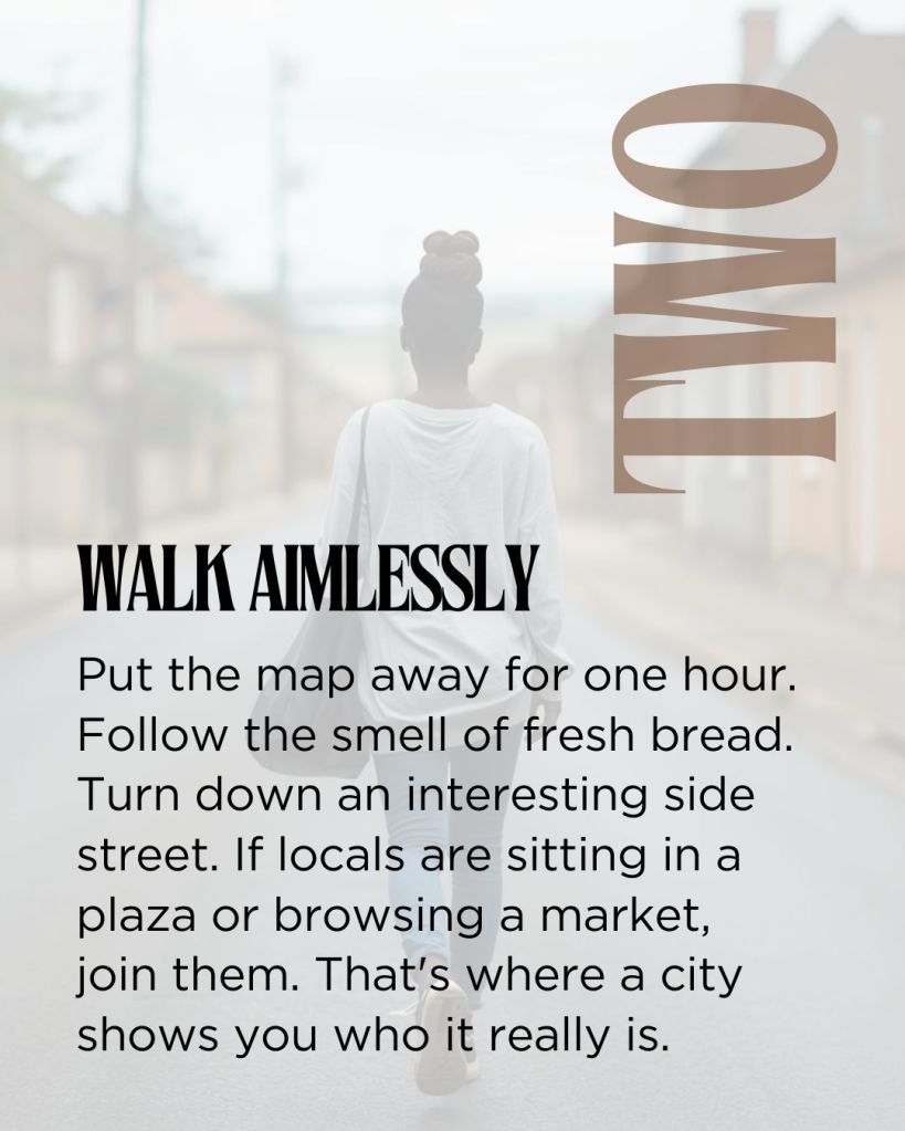
2. Walk Aimlessly (Yes, Really)
Put away the map for an hour. Turn down side streets that look interesting. Follow the smell of fresh bread. Notice the murals, the storefronts, the way other people are strolling around.
Wandering without a destination is how you stumble upon:
Local bookstores tucked between apartment buildings
Social lounges and local clubs
Parks where residents are actually relaxing along with a little Instagram posing
The Rule: If you see locals doing something — sitting in a plaza, browsing a farmer’s market, lingering at a café — join them. That’s where the real rhythm of a place reveals itself.
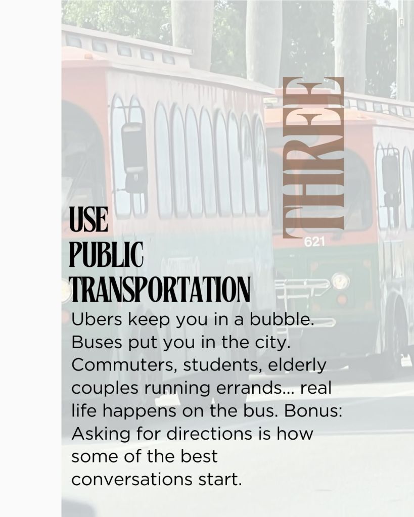
3. Use Public Transportation (Even If It’s Confusing)
Renting a car or taking Ubers everywhere keeps you isolated from the actual city. Buses, trains, and trolleys? That’s where life happens.
You’ll see:
Commuters heading to work
Students chatting on their way to class
Elderly couples running errands together
Tip: Locals are usually happy to help, if you let them know you’re trying to find your way. Some of the best conversations I’ve had started with, “Excuse me, does this trolley go to…?”
4. Shop at Neighborhood Markets (Not Souvenir Shops or Major Chains)
Want to understand a place? Go where people buy their groceries.
Farmers markets reveal what’s actually in season
Corner stores show you what locals snack on
Bakeries, butcher shops, and fish markets tell you how people cook at home
You don’t have to buy much — a piece of fruit, a fresh pastry, or a bottle of local wine. But you’ll learn more about a culture in 20 minutes in a market than an hour in a museum gift shop.
Tip: Picking up groceries, food items, coffee are almost always less expensive when you shop local.
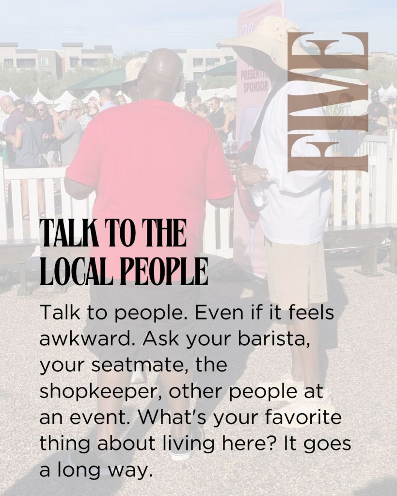
5. Talk to People (Even If It Feels Awkward)
This is the one that changes everything. My friends and family can depend on me to ask questions and get the scoop from the locals. It’s become one of my favorite parts of traveling.
Strike up conversations with:
Baristas making your morning coffee
Shopkeepers who seem passionate about their craft
Fellow diners at nearby tables
People sitting next to you on the public transportation
Ask simple, genuine questions:
“What’s your favorite thing about living here?”
“Is there a spot locals go that tourists don’t?”
“What should I definitely try while I’m here?”
Most people love sharing their city with someone who’s genuinely curious. And those spontaneous conversations are the stories you’ll remember long after you return home.
The Heart of It
Traveling like a local is about showing up with curiosity, respect, and a willingness to slow down.
You don’t have to choose. You can get the shot and still stay present. You can build the itinerary and leave room for connection. It’s about content and connection. Photos and feelings.
Because the truth is, the best parts of travel aren’t the places you go to, they’re the way those places make you feel. And that only happens when you step off the tourist track and into the actual rhythm of a place on a day-to-day basis.
So next time you travel, ask yourself: Am I just visiting, or am I actually here?
What’s your best tip for exploring like a local? Drop it in the comments — I’d love to hear how you explore new places.
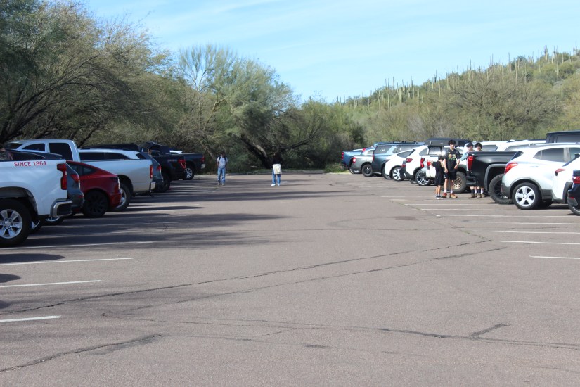
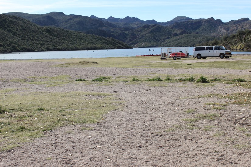
Arrived at Saguaro Canyon at 10 AM and the first thing you notice isn’t the trailhead—it’s the parking lot choreography. Vehicles circling like vultures, waiting for hikers to pack up and leave, drivers nudging into spaces as quickly as possible. We circled once before surrendering to the overflow lot we’d initially passed on the way in. Immediate evidence this trail is loved hard.
Butcher Jones Trail Parking Lot
I almost died once on a hike up South Mountain’s Holbert Trail. My sister insists I was nowhere near death, but when you’re gasping for air halfway up a 1,000-foot elevation gain with no clear sense of how you’ll make it back down, semantics don’t matter much. That was my last time hiking Holbert Trail.
Recently, I wanted to investigate Butcher Jones Trail in the Tonto National Forest. Both trails are rated moderate by AllTrails.com. The key difference? Butcher Jones has a much more forgiving elevation gain at 638 feet compared to Holbert’s punishing 1,000. But what really drew me here was the numbers: 4.7 stars from approximately 11,000 hikers. When a trail gets that much traffic and maintains that rating, I want to know how—and at what cost to the ecosystem.
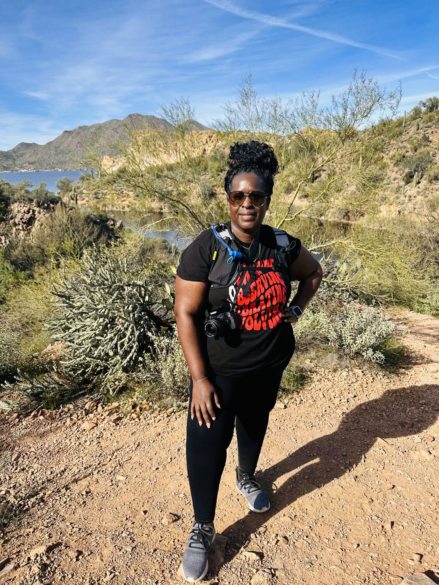
Starting the investigation with a full water pack, camera. and curiosity
THE DAM THAT CREATED SAGUARO LAKE
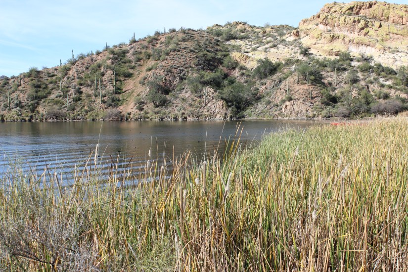
Butcher Jones is nestled just about an hour east of the greater Phoenix area, but the area I was about to explore didn’t exist a 100 years ago, at least not in this form. Saguaro Lake was formed by the Stewart Mountain Dam on the Salt River, built between 1928 and 1930. Once a free-flowing desert river became a reservoir serving as storage for irrigation, municipal use, and hydropower.
A Saguaro Lake Guest Ranch was built in 1927 during the construction of Stewart Mountain Dam to host workers during the build. Around 1930, once the dam was complete, a couple from Kansas purchased the land to be turned into a public use area. The transition from industrial construction site to recreation destination was complete. Fishermen came first, then hikers, then… the Instagram and TikTok generation with their 11,000 AllTrails reviews.
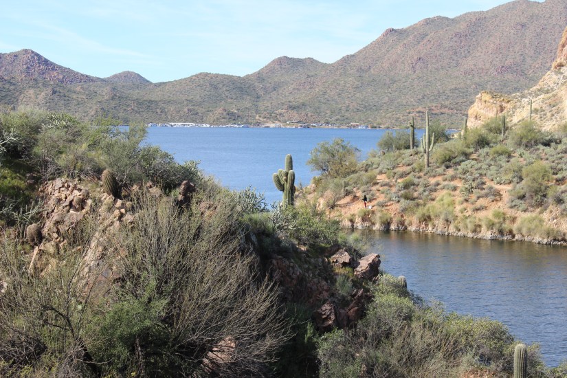
Saguaro Lake at Tonto National Forest
This trail wasn’t built for scenic overlooks or social media sunsets. It was constructed for one functional purpose: giving fishermen access to the lake. But somewhere between then and now, it became one of Tonto National Forest’s most-visited sites. The land has been responding ever since.
We fitted our water packs on our backs—pre-filled with chilled water bladders, protein bars, grapes, and hand sanitizer—and made our way through the bare recreational area near the lake. I took in the serene Saguaro Lake, then looked down at the ground beneath my feet: bare earth where grass once grew. This area hosts picnics, volleyball games, and serves as the launch point for fishermen entering the lake with their kayaks. The soil was packed hard, compacted by thousands of footsteps, coolers, and kayak launches.
Recreation Area at Saguaro Lake
A couple passing offered the advice of figuring out something else because: “The bathrooms are in dire need of attention.” Another small indicator of infrastructure struggling to keep pace with popularity.
TIP: Find the nearest restroom closest to Butcher Jones Trail before making the final trek into the Tonto National Forest.
THE TRAIL TELLS ITS STORY
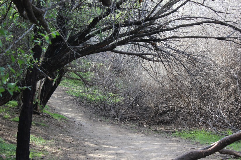
Immediately upon entry onto the trail, I noticed evidence of rerouting—new pathways carved to guide hikers away from eroded sections. Trail rerouting is one of the clearest signs that Butcher Jones has endured significant erosion over the years. The original path, worn down by boots and weather.
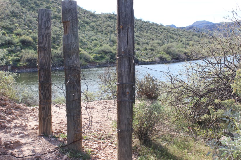
Further along, I spotted wooden posts wrapped in barbed wire—signs of an older redirect attempt. The posts stood weathered and half-buried, marking what was likely a previous effort to keep hikers on a designated path. Over time, even redirected trails can fail. Erosion doesn’t stop just because you move the route; it follows the foot traffic. These posts were evidence that this trail has been fighting the same battle for decades: how to guide thousands of hikers without letting the land wear away beneath them.
Butcher Jones Trail Posts and Wire Rerouting
As the trail descended, it became very rocky—loose stones shifting underfoot, requiring careful placement of each step. But eventually it smoothed out as we headed back toward the ascent. I paused to witness Saguaro Lake from the opposite direction: beautiful and serene despite the busy day of traffic on the trail. The contrast was striking—nature’s quiet whisper alongside human activity.
Butcher Jones Trail
There was chatter from the group behind me that they hadn’t seen the trail as busy as it was that day. Halfway through the trail, I made the decision not to attempt the full ascent. My body has changed since my breast cancer journey (more on that here), and I’m still learning what it can handle now. In a way, I’m adapting to new limits just like the Butcher Jones Trail is—both of us responding to forces that reshaped us, finding new ways to function despite the wear.
Saguaro Lake on the Back Side of Butcher Jones Trail
In Arizona, this kind of self-awareness isn’t weakness—it’s survival. The Phoenix-area trails see hundreds of rescue calls every year. Knowing when to turn back can be the difference between a good story and a cautionary tale.
WHERE DID THE WILDLIFE GO?
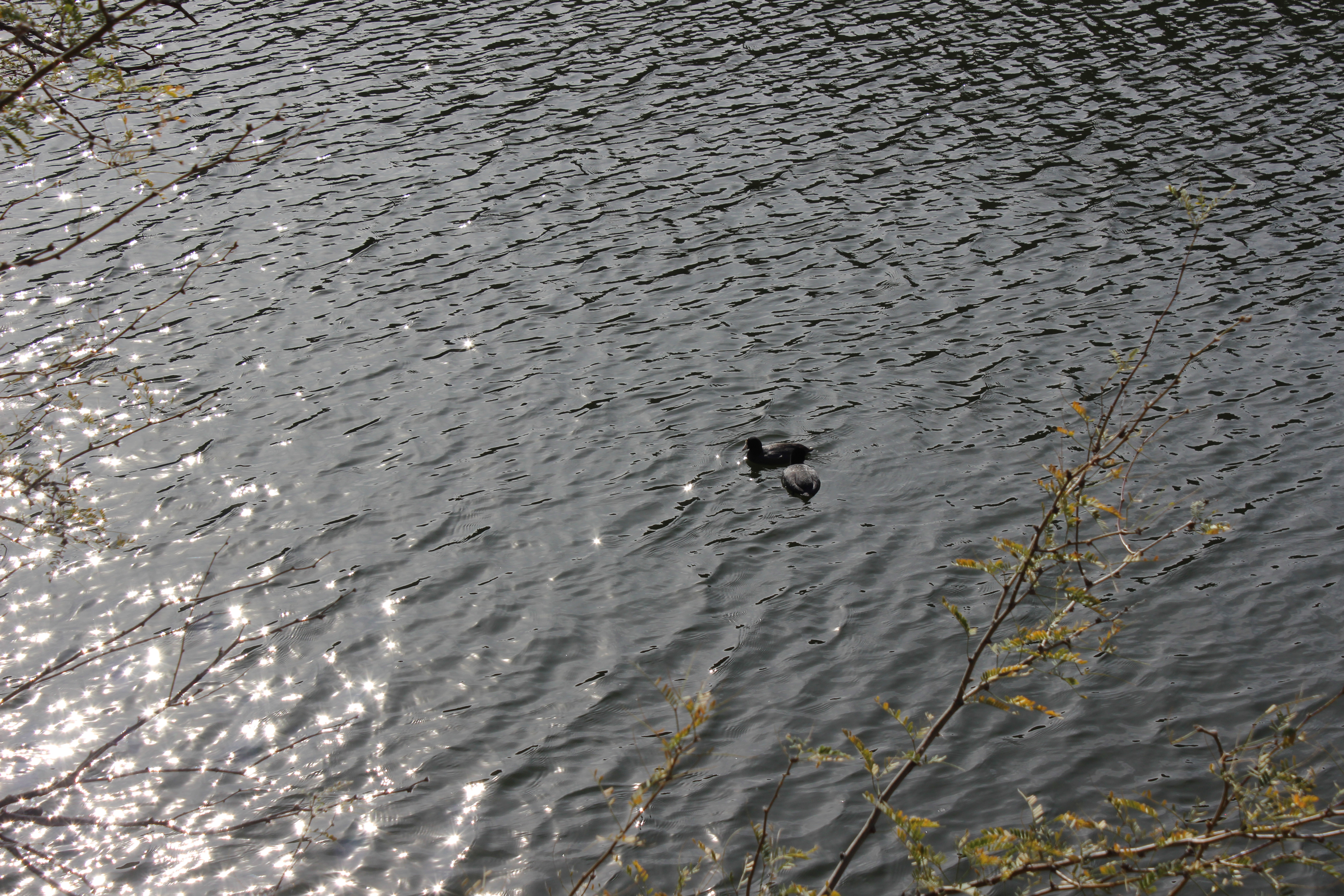
As we made our way back, I began to wonder why I’d seen no creatures besides ducks paddling quietly in the lake. I imagined even the smallest insect would land nearby for me to observe and capture. Nothing.
Ducks on Saguaro Lake near Butcher Jones Trail
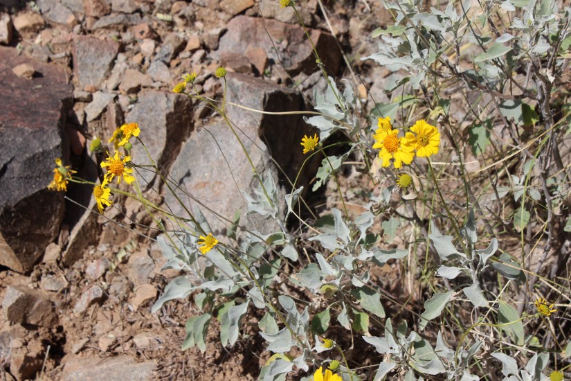
But then—a splash of color. Vibrant yellow flowers clustered along the trail’s edge, the only bright color in a brown and green desert palette. They seemed unbothered by the foot traffic, thriving in spaces where wildlife had retreated. Apparently, the animals had learned to avoid us, these wildflowers held their ground, blooming despite of.
Desert Marigolds at Butcher Jones Trail
I’m left wondering if the wildlife in the area have learned to yield to pedestrians—retreating during peak human hours, laying low so-to-speak, before returning to their routines when foot traffic diminishes. Desert animals are adaptive by necessity. Perhaps they’ve simply adjusted their schedules around ours.
It’s a pattern I’ve noticed before: in my whale watching investigation here, I witnessed how Navy sonar disrupted migration routes, turning whales back north when they should have been heading south. Here, on Butcher Jones, the disruption is quieter but just as real. We don’t use sonar, but our presence—our volume, our numbers, our footprints—shapes behavior just the same.
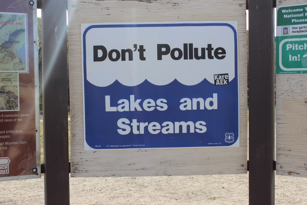
TIP: To keep the trail clean for future hikers and wildlife in the area, be sure to pack out all trash. What you leave behind doesn’t just affect the next human visitor—it affects the creatures trying to reclaim their space when we’re gone.
Butcher Jones Trail Don’t PolluteButcher Jones Trail Don’t Pollute
FINAL THOUGHTS: WHAT I CAME HERE TO NOTICE
What I intended to investigate: How a trail rated 4.7 stars by 11,000 hikers holds up under that much love—and what it costs the ecosystem.
What I didn’t expect to see: Bare ground where grass once grew, visible before I even reached the trailhead. The pressure doesn’t start on the trail itself. It starts in the parking lot, in the recreational area, in the small infrastructure struggles that signal a place stretched beyond its original design.
What I’m still wondering: At what point does popularity kill the thing we came to see? Butcher Jones was built for fishermen in an era when a few hundred people might visit in a season. Now it hosts thousands. The trail has been rerouted. The grass is gone. The wildlife seems absent. The bathrooms are failing miserably.
And yet—it endures. The lake still reflects the canyon walls. The trail, though eroded in places, still guides us to views that take our breath away. There’s resilience here.
How I’m part of this: I circled that parking lot. I added my footprints to the widened trail sections. I’m investigating this story while contributing to it, one more hiker among 11,000, one more person testing the boundaries of what a place can withstand. That tension matters.
This is part of my Paths & Patterns series—where I investigate how places and the people who love them shape each other. The goal isn’t to deter exploration. Explore with intention and attention, recognizing we’re all part of the story. The places we explore need us to see them, love them, and show up with curiosity and awareness.


Leave a comment